Modernising Map Skills
Categories:s1 and s2, Geography General
In preparing for the return to the trade tomorrow, we had quite an interesting discussion in department about where we saw the teaching of Map Skills for s1 pupils going. After looking at the Curriculum for Excellence outcomes, map skills are certainly not overly represented and, in fact, there is probably no need to teach a map skills unit. I carried this discussion on to twitter, where I was interested to note that most people were still teaching traditional map skills and throwing in a little bit of neogeography, maybe using GPS or Google Earth to supplement what they are doing. I feel in a quandary about this. I have always been a lover of maps, and I think the OS map has a level of detail that is unsurpassed in many of the other newer maps that are available online. However, in student surveys, map skills never fares well. We tried to make the material more accessible by making much of it games based- battleships for grid references, taboo and bingo games, using some of the games on the OS site for homework and so on. Still, the feedback was less than positive. In contrast to this, things like 'Using Google Earth' were commonly commented on as one of the students most positive experiences in class. Either students don't recognise that they are using a level of skill in interpreting the landscape that is essentially map skills or my teaching of map skills through this medium has not been explicit enough. So should we leave traditional maps behind, let the two battle it out like Noel Jenkins did, or stick to the old?
From this thread, I gained some good ideas from colleagues about how to take this into the classroom- How to use traditional maps in a more engaging way, and how to use newer mapping techniques. For that I am very thankful. But the key thing for me was that other teachers were having the same conundrum. I will put the links and ideas at the bottom of this post, but thought it might be useful to share the most valuable mapping resources that I have used in the last year or two, which might allow others to find something which they can use in their own teaching, or might trigger comments about other available applications which I am not aware of.
Websites
GoogleMapsMania - my favourite place for a variety of useful mashups, including a swine flu map which I posted about before. Also links to a directory, latest addition, real time maps.
Mapperz- I have recently been subscribing to this blog which shares a lot of the features that I like in the above site, and had a great post recently about the met site, really useful for teachers of Geography
Google Earth Blog- A host of info about how to get the best out of Google Earth, including imagery updates, overlays etc
Google Earth Hacks - lots of files which can be opened within Google Earth, always something within this vault which can be of use
Digital Geography- As a teacher, it's staggering to read about the ways in which Noel Jenkins uses new technology, particularly Google Earth, in his classroom. Much of what I have tried in class with regards to this has been inspired by things I have read about here.
Strange Maps- I have used the maps I've sourced here to emphasise that maps come in many shapes and forms!
Where's the Path- Great side by side satelite and OS tiles
Walking Papers- Download a map for any area and let students put their mark on OpenStreetMap
Google Earth Files
There are so many great ones which some of the sites above will flag up, and google earth has so much in the layers as well, but my current favourites are:
Gavin Brock's OS overlay - Absolutely brilliant, the OS in 3D. There were some licence issues with this for a while, but the file is back up now
360cities- StreetView is phenomenal, 360 cities is like an extension of this, but often includes areas where the streetview cameras have not been-immersive panoramas which allow students to fly into locations and explore the landscape. No need to link to the file here, as this now has it's own layer in GE
GPS and trails
Everytrail - I have been able to use this in school grounds fieldwork from my phone, record the trail and attach geotagged photos
Instamapper- We used this in the Alps to let parents track our field excursions in real time, and this could be used in a number of creative ways
Suggestions by Colleagues
Mapping News - Includes Val Vannet's 'My Patch', thanks to Victoria Ellis. Loads of good stuff here.
Also, some other suggestions included
 and
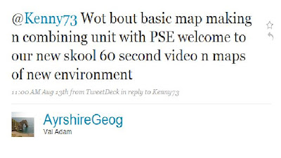
and Many thanks to Victoria Ellis, Rob Marchetto, Tom Biebrach, Mary Cooch, Val Adam, and Alan Parkinson for their input, and I look forward to seeing Alan's storytelling idea when it comes out.There are so many useful resources and ideas, feel free to leave a comment if you can think of any more.
posted by Kenny O'Donnell @ 3:08 pm
![]()


0 Comments:
Post a Comment
<< Home