Mountain People

Catgegories: Glaciation
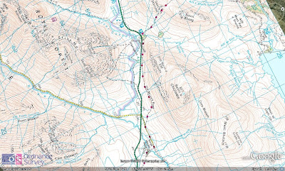
My s3 class only had a brief couple of periods on mapping and I have been reminded by them (how conscientious is this!) that they are due an assessment on Glaciation soon. I think tomorrow, we'll take a period out and use it to discover the map. As I went walking today on Buachaille Etive Mor, I thought I could use the experience and bring it in to the class. I had planned to tweet on the walk, but the weather was terrible and as I have detailed here, almost ruined my phone. I decided to tweet retrospectively using an account I set up for use in the class creating narratives and take my journey step by step. I thought this would be an ideal opportunity to use students map skills as they could try to map the tweets using some clues I have dropped in. The second aspect of the mapwork involved some questioning from me. As the weather at the summit meant that visibility was very poor, I have asked the class to tell me what I missed out on in terms of the views. Between mapping the tweets and doing this, I thought that students would have a good opportunity to use their geographical vocabulary for physical features of the landscape. The third aspect of the mapping through the tweets is where I have mentioned either land uses or conflicts. I am going to ask the class to find where these might be occuring and why e.g. Why is the hotel or the small patch of forestry sited where they are on the map, or why is footpath erosion a problem on the high ridge.


0 Comments:
Post a Comment
<< Home