Overlay Experimentation
Categories: Development and Health, Writing and Assessment, s1 and s2, Environmental Hazards
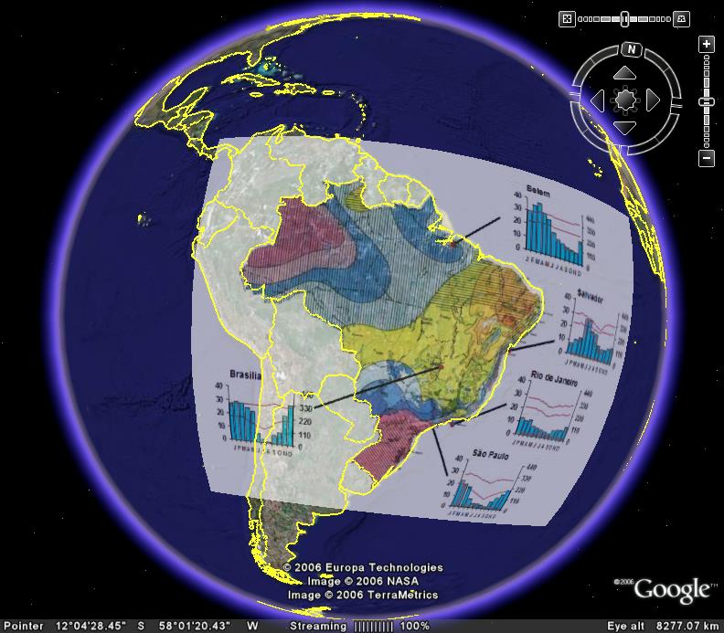
Lots to try to fit in tonight. First up, I have been doing a little experimenting with overlay maps on Google Earth, many thanks to Brendan Howard on the sln forum. I plan to use the overlays which I have created to decide on regional development levels within Brazil. I have included, amongst others, data overlays for climate, mineral exploitation, soil moisture, population density and relief. The file is here. With s2, I have some student movies to watch as well as discussion of your Hospital sites in San Francisco.I am planning another Noel Jenkins actvity, the Earthquake Shaker lesson, which we will hopefully do this or next week. I might show a video clip of an actual simulator just to start the ball rolling. s4 are tidying up the Malaria exercises, while s3 are almost finished the Physical Environments topic. For this, I would like to involve the class in a bit of online surveying. I'll stick the links at the bottom of the post. The survey basically allows you to assess elements of the unit, your own performance and provides traffic lights which will help us plan the ubite revision. For the rating of land use conflicts, I would ask you to think about conflict management via National Parks and voluntary bodies here too, as I had a limited number of questions. I am also going to go back over v-shaped valleys, as I was off when you did this and feel that the textbook is not quite detailed enough on this, something which came across during the challenge board activity last week.
Survey1
Survey2
posted by Kenny O'Donnell @ 12:12 am
![]()


0 Comments:
Post a Comment
<< Home