Fens for you...

Categories: Rural, s1 and s2
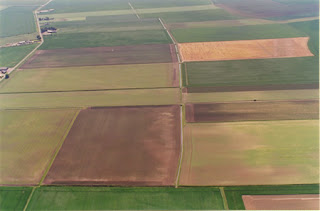
This could be useful for Higher. I feel as if I've led a lot of discussion in the last topic, so while we look at extensive commercial farming, it would be nice for you to use the case study to fill in your own blanks. I'm thinking that you could use the aerial photographs, the OS map and info about buildings etc to talk about farm layout and associated settlement/population. You could fill in your systems diagram (inputs, processes, outputs) from the sidebar menus and there's plenty about current changes. I'm hoping to finish Rural off by Monday, allowing us to move on to Industry.
I would like to let my new s1 loose on the now fully functional classroom in a box (allowed to use the wireless again). I am thinking about some presentations to shortcut some of the map skills work- Here's some themes I think people could work on:-
1) What makes a map a map? Include examples of good/bad map
2) Who needs maps? Some user collages?
3) Finding my way - I want to see prior knowledge of direction
4) How do I make a map simpler -Get-a-map, and tell me what you think some of the symbols stand for
I might add some more tomorrow, depending on a) a reliable internet connection, and b) classroom in a box being available/fully charged, and c) time, not my forte....


0 Comments:
Post a Comment
<< Home