<body><script type="text/javascript"> function setAttributeOnload(object, attribute, val) { if(window.addEventListener) { window.addEventListener('load', function(){ object[attribute] = val; }, false); } else { window.attachEvent('onload', function(){ object[attribute] = val; }); } } </script> <div id="navbar-iframe-container"></div> <script type="text/javascript" src="https://apis.google.com/js/platform.js"></script> <script type="text/javascript"> gapi.load("gapi.iframes:gapi.iframes.style.bubble", function() { if (gapi.iframes && gapi.iframes.getContext) { gapi.iframes.getContext().openChild({ url: 'https://www.blogger.com/navbar.g?targetBlogID\x3d23069377\x26blogName\x3dOdblog\x26publishMode\x3dPUBLISH_MODE_BLOGSPOT\x26navbarType\x3dBLUE\x26layoutType\x3dCLASSIC\x26searchRoot\x3dhttps://geodonn.blogspot.com/search\x26blogLocale\x3den_GB\x26v\x3d2\x26homepageUrl\x3dhttp://geodonn.blogspot.com/\x26vt\x3d8160912104340948054', where: document.getElementById("navbar-iframe-container"), id: "navbar-iframe" }); } }); </script>

Odblog

A weblog designed to share Geography resources with students and colleagues

Monday, March 30, 2009

Take a walk with us

Categories: s1 and s2, Urban
Lessons are going in cycles again, round to using this and this and lots of contrasting images for working out whether Brazil is rich or poor, Higher are doing urban mapwork (might use this) and s2 are starting some work on Environmental Issues. One thing that I liked the look of today was this, which referenced James Howard Kunstler, who helped our s1 lesson indirectly a while ago. It strikes me that this would be a great student project for a virtual fieldwork exercise? For instance, we used streetview for Higher a week or so ago to compare parts of the inner city:


Street Cities - Free Mapping and Street View Tools

We won't have time to do this now, but what would have been useful was for students to podcast on their comparisons and what features of inner cities these locations illustrated.

Saturday, March 28, 2009

Etherpad in the classroom

Categories: s1 and s2, other
We tried etherpad in class with s1 yesterday on a tip off from Alan Parkinson's blog. I had never seen this before and I have to say I am very impressed. The most surprising thing is that it was not blocked by the school web filter, as it has a chat function built in. I felt that this was actually one of the things that the children responded to. Basically, etherpad allows up to 8 different users to edit the same page at the same time. It means that the students can see each others changes almost instantly. When I explained this to the class, one of the girls said, "So, it's like msn then?". We made a compromise and said that it was like msn meets microsoft word. This definitely appealed to the class. We had a quick discussion about proper use-issues around inappropriate comments and such like, but also, as the activity that we were doing was an anonymous online debate, about editing each others sentences. I like this feature of the application, but didn't think it would work in this context.
The Activity

I split the class into pairs and then gave them a web link to type into the browser bar. The conditions were that no names were to be used, as I wanted pairs to respond with their own views and not just agree with their peers. There were two debate topics, both based on work we've been doing, and especially in relation to the clip about gold mining in the Amazon from Bruce Parry. The first topic was:

Gold mining in the Amazon should be banned. Discuss

and the second,

Tribal Indians are the only group with a valid claim on Amazon land. Discuss

This was quite testing for an s1 group, but I was pleased with some of the responses to the first topic in particular. I also allowed chat as long as the discussion was ongoing in the main page. I just thought that if this was a class debate minus the etherpad, there would probably be a lot more chat going on that I couldn't monitor at all times anyway. Finally, I was able to monitor both discussions and offer prompts and bring people back to task if they were getting sidetracked.

The Results

Here are a couple of screenshots from the activity. Sometimes the text appeared fragmented in the page and occasionally there was a lag in appearance, normally associated with a loss of synchronisation (happened several times, but quickly fixed).

and then more sustained responses like this one

At times, the discussion also became quite heated- " No! Gold mining is wrong, wrong, wrong!" and sometimes more ludicrous and less practical- "make fake gold instead", but the exercise was generally a good one. The chat was utilised, but as I was able to monitor it, whenever I made a contribution, the students quickly got back to work :-) I think the class enjoyed the exercise and a couple asked if they could continue with it next period. After experimenting with this, there are a number of ways that this could be used, not just in Geography. More trials with this until the inevitable hand of websense falls upon us...

Tuesday, March 24, 2009

Coded messages, streetview and little earthquakes


Categories: Urban, Advanced Higher, s1 and s2, Geography General, Other
I haven't blogged much in the last week as I've been busy with other work commitments and have also been trying to get used to what my new phone can do in terms of class work. Some interesting experiments, if I don't include the etch-a-sketch application which my two kids have been playing with... I installed a QR code reader after hearing Victoria Ellis's tweets about this on twitter. I thought of two potential uses for this in and around the school grounds. Our s1 map skills unit needs something else and I think that if I was lucky enough to have a classroom assistant with me, small groups could do some detective work around the shool building and grounds in a variant of geocaching. Once the original 'treasure' had been located using strategically placed QR codes, the group who found this could create their own QR clues for the next group and the treasure's new location. I might ask Mr Kerr to become involved in the next idea. We do an environmental quality survey of the school grounds with s2 near the start of the Environmental Issues unit, and I thought this might be an ideal opportunity for some guerilla geography, leaving their thoughts around the school in code, which will also hopefully spark some interest from other people and something which maybe the students themseves could 'guest' blog about on the eco club page. I've also been playing with a few weather and GPS applications for the phone too, and I'm currently looking at a compass which seems like it might be useful.
I wish I'd recorded the streetview exercise that Higher did on Friday, as I thought it worked really well for a comparison of inner city areas. I'll hopefully have something for tomorrow using this to look at the suburbs and beyond in Urban Geography. I loved urban geography at school, I just found a lot of it quite common sense, but I think we should have a chat about what the class has already done tomorrow. Sometimes I feel this is an area I've raced through too quickly with students before, perhaps because I don't see the complications that I might in some of the scientific topics like atmosphere.
Advanced Higher have really started to work their Study topics. I feel a lot more comfortable now about the volume and quality of work, but we'll also need to think about the final NAB, which relates to this. I'll talk about this tomorrow. s1 will probably have a look at some issues in the rainforest through Bruce Parry, after a bout of sting ants :-)
Finally, two asides. I am going to a launch for free school seismometers in Edinburgh soon. There is some training which follows in June and I think this would be just fantastic to have in the classroom, talking to students about tremors which are happening in real time. I am also interested in whrrl, should it come out of its US only mode to use in the Alps in June to tell a story about our trip. Last year we used twitter, this blog and flickr, so it would be nice to tell it through one platform. Speaking of the Alps, this excellent video got me thinking about glaciers, thanks to the Google Earth blog:


AK-03 Columbia Glacier from Cliff from Extreme Ice Survey on Vimeo.

Wednesday, March 18, 2009

Words from the experts


Categories: s1 and s2

I've been thinking about using excerpts from Ernest Shackleton's writings and Hillary's 'View from the Summit' with s2 tomorrow before we attempt to look at the qualities of a polar explorer. The idea is appealing because there is plenty of other information about the landscape and climate in the texts. As we have already thought about the climate through looking at survival essentials, it's also a logical extension of the work. Hillary's journey in particular is very revealing about the physical geography of the Antarctic from a mountaineers perspective (albeit one crossing the continent in a tractor!) and I also think that this type of activity could really extend some students too. I think we'll start with this clip which introduces Shackleton and his crew to the class. This gives a nice introduction to the type of men who accompanied the explorer on his journey, as well as giving good insight into the character of the man himself. I think with the excerpts we could look at a number of things. Some students could look at vocabulary about the landscape or climate which they would like defined, we could look at descriptive words for the climate (and maybe wordle this?), we could do back to back with one student reading the text and the other sketching the scene, labelling as they go. There might be the opportunity for students to look at the passage and do a 'weather or climate?' type activity (classtools quiz for the class once they have established the answers?), and at the same time, we could repackage the wordle idea for our explorers personal qualities, as while doing the activities, students would also be noting down these to share with the class.

Tuesday, March 17, 2009

Playing with the new toy

Categories: Geography General
I bought a Blackberry Storm recently, as I've been looking for a phone that's got built-in GPS, has a decent camera and a good web browser. I thought about an iphone, but I had to pay for the handset and the tariff was dearer, plus I didn't think the camera images looked good enough for what I wanted to use it for (although I still think my Sony k800i takes slightly better photos than my new phone). There were a lot of useful applications for it, but I just liked the look of the Blackberry for me. I downloaded a couple of applications for GPS at the weekend and have been trying them out.
I used Everytrail tonight for part of the journey when driving with my kids to pick up my wife from work. I turned it on from my sisters house and stopped it, I'm ashamed to say, at McDonalds for a bite to eat before going on for the pick-up. On the phone it was very fidgety, and despite the touch screen working perfectly during normal use of the handset, with this application, it was like using a non-callibrated whiteboard-the touch was all over the place. I was, however, impressed when I got the track onto the web at home. On the website, there is a map with the track and the elevation, speed and distance by its side. Further to this, you can then visualise your journey again by playing it back.
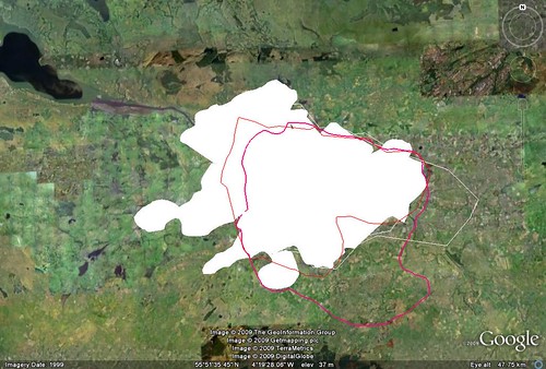
I didn't stop (Chicken nuggets happy meals were being demanded), but had I taken a photo, the image, I'm pretty sure from my reading, would have appeared along the track where it had been taken. There was also an option to download a kml file for Google Earth, which you can see in the image at the top of the post. Overall, this is something that I think would be really useful for documenting fieldwork easily. Incidentally, the phone is also set to geotag photos so that if, for instance, I uploaded a picture to flickr, it would automatically give its location.
The other application is map my tracks, something I blogged about before and wanted to use for such a long time. This allows you to view a persons track in real time, which would be great for getting students interested in maps (Noel Jenkins did something similar using his iphone). Unfortunately, I lost patience trying to get by log in on this, which seems impossible. The dashboard on my phone for this application was just so rigid, and I could put in my username, but not my password. I might try a re-install as this worked out a few of the initial problems with Everytrail, but this was so disappointing as I'd been looking forward to using this so much. Does anyone know other applications for GPS which might be worth a look?
Finally, with a tenuous link as I've been talking about both Noel Jenkins and maps, Noel's recent post on Digital Geography has highlighted the availability of OS maps in Google Earth, which is fantastic news for the classroom- no more fighting with overlay sizes!

Monday, March 16, 2009

From Argyll street to Amundsen-Scott


Categories: s1 and s2, Urban
Hard day today. I thought the lesson with s2 went OK, lots of good class discussion, but maybe just a bit too much- I could have probably broken up the work a bit better with hindsight, with a better variety of activities. Things that seemed to work quite well were the illustration of the scale of the journey, the size of Antarctica and the difficulties in travelling to the continent. Tomorrow, we are looking at the idea of what essentials we would take and what qualities an expedition leader would need. I'd like to use 'March of the Penguins' in short clips for both climate and adaptations at some point this week or next. I think we'll complete a climate graph before we do this for two or three points on Antarctica, and use this as a recall exercise for why the temperatures vary so much across the continent. I really liked the idea from Pauline Wright of the sln forum (link in sidebar) for extracting information from the film clips. To quote,
"to evaluate different forms of taking notes - have one group jotting down key words /linear notes- another group doing a spider diagram on A4 sheet/ spider diagram using A3/ using colours/drawing pictures/control group making no notes but have to recall at the end. Plenary - in groups compare method or use it as a stimulus for a piece of creative writing - life of a penguin!"
We might not do all of this, but certainly, this would be a good example of students 'learning to learn'.
s1 last period was very draining. I don't feel I've really established myself as the class teacher here yet as I've been sharing duties with Miss MacKay. I need to get to know the pupils better and set out some routines, and tomorrow while we complete the ICT work we started today on the Amazon, I think I'll take the opportunity to have a look at some work and a chat to some of the class.
Finally, it was unfortunate that my first period back with Higher was going over the prelim paper. I compared the results to last years prelims and they are much of a muchness, but there are definitely areas for improvement across the board. The hydrograph and energy balance questions were particularly difficult for some. Tomorrow, I'm going to, given the chance, do a moving activity to place images in city zones as a recap on the class work on urban models. Next up will be an exploration of the CBD of Glasgow using the presentation above

Sunday, March 15, 2009

Confusion Day

Categories: s1 and s2

Back to work tomorrow after a week in the sick bed. One of the things that is really hard to do when you return from some time off is get your head round where classes are in the scheme of work. Fortunately with Higher (prelim fallout) and Advanced Higher (essay work), I don't have much to worry about, but s1 and s2 are a little more difficult. I think with s1, I'll move on to look at issues in the Amazon after some q & a on the work you have been doing in my absence. I hear that Miss MacKay was doing cartwheels during capoiera, so no doubt there will be some stories to tell. With s2, this is a bit harder as you were in the middle of some work on the laptops and I'm not sure if you would have had access to complete this. I thought as a mini topic, we could link climatic regions with environmental issues through looking at the e-base, which I've been following with interest.
I think a good starting point would be to think about the physical geography of Antarctica. For instance, I can't assume that everyone knows where it is, or how someone travelling from here would get there (and how long it would take?). There are lots of activities here and I think we could adapt a few of these for tomorrow. I'm going to start of with a blank map of the world on the whiteboard and a blank piece of paper on your desk. From that, I'm going to ask you to put a cross on the paper where you think a) we are and b) where Antarctica is. From that, we are going to have a look at planning a journey to Antarctica. First of all, how would you get there? Where would you stop? How would you travel? I think we should probably start by looking at a distance as the crow flies on Google Earth and discussing this backwards-Why not just fly straight there? This video might illustrate some of the problems, but I would also like to discuss who owns Antarctica here, as a potentially troublesome factor.

So, we assume that we get there, we draw our route on GE and we reach our base. But where should our base be and what should we have brought? Time for some climate statistics, and I'd really like students to think about reasons for the differences by location. Finally, we'll look at another clip from the e-base and ask what qualities a person going to Antarctica as part of such an expedition would need. I think we'll adapt the Antarctic passport as a homework exercise. I'd really hope that after our mini-topic, we could have some questions for the message wall .

Sunday, March 08, 2009

City limits

Glasgow Boundary Experiment
Categories: Urban, s1 and s2
Had an up and down day on Friday. Downsides came last period with s1 and the dreaded tech problems when trying to show a youtube Rio carnival clip. This kind of took the momentum out of the lesson a bit. I have seen enough to think the lesson could be a very good one, but I think I'd zamzar the youtube clip in future just in case. Up sides came from Higher who did some really good work through Google Earth, which I'd hope to continue tomorrow (unless I get enough marking done tonight to go through the prelim instead). The students gave some really good accounts while defining both the city centre and the boundary of Glasgow. The image above shows some of the files sent to me for the boundary and it would be good to compare these in class too. The city centre file is here, but doesn't include all the explanations, which are somehow omitted when recording a tour in Google Earth. Would like to continue the follow up activity detailed in the previous post.
With s2 tomorrow, we'll hopefully build on the mish mash of Thursday. Had some hungry students eating their way through a mediterranean diet after a long promise from myself- olives, peppers, blood oranges, figs- with desert foods dates thrown in for good measure. We then discussed the qualities of these foods such as the waxy skin as to why they would thrive in the climates that they grow. We then had some time for those who had not already done so to finish off the Dubai homework exercise by creating the placemark in Google Earth for where they would site their sustainable hotel. Will put these on here soon. Finally, we just about got back to where we should have been, which was looking at rainforest climate, vegetation and wildlife through Bear Grylls. We have access to the laptops again tomorrow, so should be able to finish this work. s1 are still learning about people in Brazil, and we have capoiera dancers coming in to the school on Tuesday through Miss MacKay-should be good.

Thursday, March 05, 2009

Know your place (Glasgow, that is)


Categories: Urban
When I left work today, I had all but one of my lessons for tomorrow planned. As it happens, this one lesson has taken me forever, and it's still not very inspired, so apologies. We are just about finished Industry with Higher, and normally teach the Urban topic next. The booklet that we are going to use covers urban models before site, situation and function, but I think it makes much more sense to look at these first. I thought I'd start the period with some sounds from Sauchiehall street in Glasgow, our case study city. This is a topic which last year seemed to come very easily to students as you are on (literally) such familiar ground. This is just a bit of scene setting. I'm expecting that when I play it, some people will guess that it is the city centre. I think at this point, I'd ask you to identify the city centre with a placemark in Google Earth. I'm going to then identify a few other sites which I will tell you were the city centre in a past life- we'll come back to these.
I'm then going to ask you, still using Google Earth, to look at the wider area of Glasgow and, using the path tool, draw a line around Glasgow where you think the city boundary lies. I'm going to ask you to write up a reason within the description box as to why you think the city stops here-Are there physical boundaries which make further growth difficult, for instance? Send your placemark to me, and then I'll look at the site of Glasgow in a little more detail on the whiteboard. Following on from this, I'd like to look at the growth of Glasgow, and to do this, we are going to have to look at situation, so again, we'll take the zoom out a bit more and add a few layers, such as roads, borders etc. Finally, I'm going to go back to the idea of the changing city centre by looking at the function of Glasgow over the ages through this. I think you should probably use this yourselves and make your own notes from it, but I'm also going to ask for 3 questions from each pair about this by the end of the period to build on your knowledge next lesson.

Tuesday, March 03, 2009

Dubai- some of the contenders

Categories: s1 and s2
I tried to scan a few of your designs today for the Dubai homework, and thought I'd display what I got through. Please do not think that your own effort is not being considered for top spot if it's not here. There are some outstanding efforts that I just haven't had the time to scan yet. I'd have liked to have included the google earth placemarks. Not everyone has managed this yet, as you don't all have access to Google Earth at home, so we'll try to factor this in to class time using the laptops.
Was also talking to Mr Docharty of Craft, Design and Technology today about the possibility of doing this as a cross-curricular project in future. He's keen to have a look at your designs too, so may ask him for some advice in the judging. Well done to all!


Going to Samba school...

Categories: s1 and s2
I am writing about an idea for a lesson given to me by Miss MacKay, who is with us for 6 weeks at the moment. I am sharing it because I thought the concept for the lesson was outstanding. I would never have thought to teach about people in Brazil in this way, and will certainly have to come out of my comfort zone to do so. This is a follow up to a mapping from memory exercise which introduces some of the different ethnic populations of Brazil. The lesson would start with an introduction to Carnaval through a video like the one below


1) Tell students about the origins of Carnaval- A Christian celebration brought by the Portuguese to signify the start of lent. Talk about the influence of African culture on the celebrations
2) Ask students to comment on the stadium, the costumes, the themes in the video
3) Talk about the role of the samba schools- 12 official schools with 2-3000 participants. Where are the samba schools located? How do they choose their 'enredo' (theme) for Carnaval? Apparently, these are often quite serious themes from history, as well as being celebrations of something or based around a particular concern.
4) Introduce the meaning of Samba, a variant of an African term 'Semba', which means to pray. The drums and dance are also part of ritual worship, but were hidden through celebratory song and dance in the Portuguese led Catholic culture of Brazil. Once free, the 'slaves' moved to places such as Rio and the favelas
5) Organise pupils into 'samba schools'
6) The educational task is to commemorate the slave trade through samba songs
7) Teacher led discussion about the slave trade- Who, what, where, when, why? All of the responses on the board for use when students are writing their songs
8) Pupils to collaborate on song while 'Best of 2009 Samba' songs are playing. Remind students that although the tempo is upbeat, the lyrics are serious
9) Pupil performance as a plenary
Looking very much forward to trying an excellent and innovative idea- Thanks very much, Miss MacKay!

Monday, March 02, 2009

Ogres have layers...

Categories: s1 and s2, Industry
I enjoyed the reaction to Fergus in s2 today. We will revisit the theme of food on Thursday, but tomorrow, we start our last climatic region, one you will already be quite familiar with, the rainforest. Last year, you looked at people in the rainforest, but this time, we are more interested in the natural environment and habitat. I'm therefore going to start with no image, but maybe some sounds to start our mind movie which will place us in the middle of the forest. Sights, sounds, taste, touch, smell will all be considered as we try to imagine what it would be like. I think we'll then see how Bear experiences the environment. Your challenge here will be to try to summarise the physical environment, including the climate, from the clips. Then we're going to leave Bear behind (sorry, Ronan) and look at the idea of forest layers. I saw an idea somewhere for this a while ago (probably also on sln) which used pupils to recreate these, but I liked the idea of David Rogers on sln of using this video clip as a starter- What has Shrek got to do with the rainforest?


There might be the chance to visit a webcam in class too to see what's going on in the TRF.
Industry again with Higher, now that the prelim is by with. I'll need to go back and look at how you classify industry and locational factors, and I think I have a dustbin game on classtools , which I'll try to edit to put some examples from your case study into it.
I had a period to forget with s1 today which was as much my own fault as anything else. As I thought I was co-oping, I didn't prepare my own lesson. Unfortunately, Miss MacKay had to go home ill this morning and left a very good resource for mapping from memory to build on our intro to Brazil. I have done this activity many times with other topics and assumed that it would run itself. I should really have familiarised myself with the resource a little more before using it, and the lesson was more than a bit disjointed. I'll try to bring this back together tomorrow, but I'm also keen to try that activity again with my other rotation- but this time with a bit of preparation!

Sunday, March 01, 2009

Food, feedback and foraging


Categories: s1 and s2, Geography General
More s2-students in the class were asking me the other day about food, talking as we were about some mediterranean foods. I am bringing in dates, olives and a few other goodies later in the week but thought this would be a good time to revisit food miles. Two years ago we did a mini project with s2 on this very topic, and my starting point was Fergus Drennan , pictured in the youtube video above, who is a campaigner for eating wild, local food. I don't think we'll do a project this time, but I'd certainly like to explore the issue of where we should be getting our food from. I'm hoping that tomorrow, we can define what's meant by food miles, understand more about where our food comes from and then look at the issue of international vs local foodstuffs.

In other classes, Higher are going over the first paper of the prelim, which everyone has sat. Some soul searching for a few of us, I think, in terms of whether we are really doing enough for ourselves at this time of year :-( I am hoping that Advanced Higher are armed with some further fieldwork results to be running with, and we still have two Issues essay redrafts to talk through. I think we'll go over your prelim on Wednesday. s1 have Miss McKay running the show tomorrow with myself the support act, so I'll wait on my orders. Meanwhile, I liked this video on adaptation from amybee on the sln forum, many thanks, this will come in handy I am sure :-)


To blog or microblog?


Categories: s1 and s2, Geography General
I was reading an article yesterday about how twitter is apparently leading to less people writing regular blogs. I have to say that I've become quite reliant on it, it's an absolutely great place as a teacher to share ideas and to watch other ones develop as responses are limited to 140 characters. I'm not sure about the merits of pupil use, but I have been thinking about this type of 'microblogging' for looking at how well students have understood learning intentions. Regular readers will be aware that I've been using edmodo primarily with s2, and have found it to be great for collecting homework evidence, but a few members of the class have latched on to the fact that they can leave messages for the group. It would be nice to encourage more people to use this function in a fruitful way to check understanding. I'm going to ask s2 to traffic light their comprehension of the next two weeks of lessons (6 periods) and ask for comments to be blogged through edmodo, where there is the option to make the comment public to the group or direct to me. I'd really like to encourage a free discussion of work through this platform, and see an extension of this type of activity into online debating (something I think would be particularly valuable for the upper school).