<body><script type="text/javascript"> function setAttributeOnload(object, attribute, val) { if(window.addEventListener) { window.addEventListener('load', function(){ object[attribute] = val; }, false); } else { window.attachEvent('onload', function(){ object[attribute] = val; }); } } </script> <div id="navbar-iframe-container"></div> <script type="text/javascript" src="https://apis.google.com/js/platform.js"></script> <script type="text/javascript"> gapi.load("gapi.iframes:gapi.iframes.style.bubble", function() { if (gapi.iframes && gapi.iframes.getContext) { gapi.iframes.getContext().openChild({ url: 'https://www.blogger.com/navbar/23069377?origin\x3dhttp://geodonn.blogspot.com', where: document.getElementById("navbar-iframe-container"), id: "navbar-iframe" }); } }); </script>

Odblog

A weblog designed to share Geography resources with students and colleagues

Thursday, February 28, 2008

Fens for you...


Categories: Rural, s1 and s2
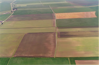
This could be useful for Higher. I feel as if I've led a lot of discussion in the last topic, so while we look at extensive commercial farming, it would be nice for you to use the case study to fill in your own blanks. I'm thinking that you could use the aerial photographs, the OS map and info about buildings etc to talk about farm layout and associated settlement/population. You could fill in your systems diagram (inputs, processes, outputs) from the sidebar menus and there's plenty about current changes. I'm hoping to finish Rural off by Monday, allowing us to move on to Industry.
I would like to let my new s1 loose on the now fully functional classroom in a box (allowed to use the wireless again). I am thinking about some presentations to shortcut some of the map skills work- Here's some themes I think people could work on:-
1) What makes a map a map? Include examples of good/bad map
2) Who needs maps? Some user collages?
3) Finding my way - I want to see prior knowledge of direction
4) How do I make a map simpler -Get-a-map, and tell me what you think some of the symbols stand for
I might add some more tomorrow, depending on a) a reliable internet connection, and b) classroom in a box being available/fully charged, and c) time, not my forte....

Scotland the invisible nation?


Categories: Advanced Higher

Having a really frustrating time tonight, as it appears that in many websites eyes, Scotland doesn't exist. I have been looking at a few websites flagged up which could perhaps be used by Advanced Higher in your Geographical Study. The first one is neighbourhood statistics. You can get all sorts of data about crime, benefits etc, and this would be particularly useful for Antony, Andrew and Katharine, I'd think for your particular projects. I tried creating a map of benefits claimants for Glasgow on this, but it's still loading (50 minutes trying). We could have a look at this again tomorrow. Some sites were mentioned in the magazine of the GA, which admittedly is an English publication and the suggested sites look excellent for English schools. I tried House Price Maps, which would have been particularly useful, as you can choose prices by years, and would be able to compare prices e.g. before and after certain tourist developments, Katharine? or comparison of house price changes in your commuter settlements, Andrew? I say would have been particularly useful as, according to the site, no houses have been sold in Scotland for 8 years...I also tried mouse price, which again is great...if the area you are studying is in England. You can get house price data elsewhere, but maps would have been good to use in your work, so I'll keep searching- although I'm drawing a blank so far. I did have some success finding a flood risk map tool on the SEPA site for the two students doing the river study. This might be useful for your evaluations of your fieldwork, as I know the weather and the fact that a spit in the river seems to send it into spate have conspired a little against you in terms of your favoured sites of sampling.

Wednesday, February 27, 2008

The Geography of Counting Money?


How People Count Cash? - Watch the best video clips here

I don't know why, but this appealled to me. Perhaps it's a distinct post-Christmas lack of the subject matter...

Tuesday, February 26, 2008

Labelling in Flickr


Waterfall
Originally uploaded by
Andy O'Donnell
I am playing around with flickr to label photographs. I'm thinking about this for revision homework, particularly for Higher. For topics such as Lithosphere or rural this would be really valid. We have spent the last week, for instance, talking about the field layout, farming system and settlement patterns associated with shifting cultivation and intensive peasant farming- all from web images. What this allows us to do, providing we have a flickr account, is label the photos ourselves. It's very simple to do, and if you click on the picture to link to the original, and then hover over it with the cursor, you'll see the result. Incidentally, I have one of my brother's to thank for the photographs. He is a mad keen photographer, and you could have had Berlin, Brussels, Prague, Switzerland etc....I gave you the Campsie Fells. Apologies :-s
Good Luck with Part two of the Higher Prelim tomorrow, I've updated the wiki questions page with a
response about glacial deposition.

Sunday, February 24, 2008

Business end of the year...


Categories: Rural, Environmental Hazards

Higher prelim part two on Wednesday. We have sat the papers the other way round to allow us to complete the rural topic for Paper 1, so it's really important to make the most out of the time we have tomorrow. We're finishing off the Green Revolution, and I would like to show you a couple of the youtube videos embedded on geographyalltheway. Unfortunately, the school filters youtube, so I've converted the files using zamzar, and should be able to use these with students. There's also an accompanying worksheet. I might use this in class, but that depends on time. There's also a nice compact case study summary sheet on Geointeractive (bottom of the page). I know this is a topic you covered last year, it's vital that you are able to talk about recent changes and the impacts of those changes. I may not be at school on Tuesday, so please speak to me tomorrow about any worries, or post me a question.

As I missed the s4 on Thursday due to the Edinburgh trip (bookwork), and may miss you again on Tuesday (em, bookwork...), I thought I'd shoehorn a Montserrat period in for you. Thanks for the third time to Noel Jenkins who has produced the set of resources for this activity. This fits perfectly with where you are in the course just now, and hopefully you'll enjoy. I have a mountain of marking building up, with Higher Paper 2 (semi completed), Advanced Higher prelim and some Issues drafts as well as another Higher paper come Wednesday, so please be patient with me in the next week or so, I will get this back to you as soon as it's possible.

Thursday, February 21, 2008

Nice Rice


Categories: Rural
There are some outstanding photographs of an intensive peasant farming landscape on flickr, like the ones above from user flippedout. I think I'll try to discuss some of these tomorrow with Higher before we look at labelling a field sketch detailing field layout and the farming system. This is a popular type of question, either in NABs for the GMT, or adapted for the Higher exam.


More twittering


Categories: Geography General

A while ago, I posted about a web service called twitter. I said I'd like to explore this at some point, and between inspections, enterprise events and after school courses I've been presenting, I kind of forgot all about it. Basically, as I see it, it's a way for you to tell people what you are up to while you're on the move. It's a bit like SMS texts. If someone decides to follow you on twitter, they can get updates sent to their phones, or else they can access what you've been doing through the internet. Anyway, I got an indirect reminder of this through an English colleague, and set to thinking how I could use this with classes. Here's what I've been thinking...

1) For communicating in the summer from the Alps field trip. Last year, I tried to blog from the Alps using my phone -did this retrospectively- and had some difficulties ( I was trying to send photos to flickr/blog, and my i-mail wasn't working). My ordinary text messaging was fine, as long as it was just text. I think we could probably use twitter to keep people updated on where we're going/where we've been etc. I would be quite happy to let students do some of the updates, it's your trip. Your friends/parents could be following your journey through text updates, and it may save you a few bob too.

2) For Advanced Higher Diary/Fieldwork. Quite a lot of the time at the moment, I find myself starting a period asking for updates on fieldwork for the Geographical Study- What have you done, where have you been, why did you choose certain sample points, what were the difficulties in your sampling methods etc. I think we could maybe utilise this in the same spirit that we've used bloglines this year, and use technology to make things easier for all of us. I could follow your updates and would have my own record of how you've been doing. This would certainly allow me to be more focused on particulars of your individual fieldwork in class as I'd already know the bulk of what you had achieved. You would have an informal record of what you'd done and could then write this up - something which I've noticed hasn't been so easy if you haven't kept an accurate field notebook. The great thing about both of these ideas is that I don't have to disclose my mobile number to anyone and neither do you.

It would be easy to be sceptical about twitter as just another way to tell people you don't know more things they don't need to know about, but I think this is something that both students and parents might quite like. I tried using twitter last night and today when we were out on a trip, and another major plus is that it's really simple to work with. I'll be mooting the idea to Advanced Higher next week, we'll see how we get on with this.

Monday, February 18, 2008

Downside of a technological existence :- (


Categories: Rural, s1 and s2

I had unanticipated problems with the whiteboard today as it just didn't want to play,although last night's post might have been slightly prophetic looking back. As such, the slides I wanted to use formed the basis for more of a discussion today. I know several of you were taking notes, but if you download the powerpoint, and check the notes under each slides, I've tried to give as comprehensive an overview of the case study for Shifting Cultivation as I can. Hope it's of some use. In fact, scrub that about downloading the powerpoint, I have just checked back to see that there are 1760 documents ahead of mine in the queue... Another problem with relying on the internet! Hopefully not about to get some computer rage...I'll post the link here and embed tomorrow. Tomorrow, s1 will continue with their course evaluations and poster tasks for Katrina- a bit of everything as we'll need to use the computers, work on poster illustration and use some textbooks to help with the basics about hurricanes. Over and above this, I'll have Google Earth opened on the PC in my room as you plot your placemarks for your must-visit cities. I might play the Hurricane song too....

Update: Here's the powerpoint now. remember you need to download it to see the notes

Fresh Fruit Hazards

Categories: Environmental Hazards, Advanced Higher
I slightly misjudged time on our quickie bag task today (rather ironic), and as a result, I am looking for a strong performance from the fridge in the staff base tonight. A reminder about some of the materials used, in no particular bag or order; magnets, tangerines, apples, staples (straightened), footballs, paper, scissors, pens, blue tac. Some interesting ideas and some other, frankly, bizarre ones! Lots of jigsaws being made from paper, many dissected tangerines, one apple with a red penned centre (and another with one segment removed- very skilfully too..) and a makeshift compass from a bowl of water. More importantly, slowly but surely, understanding of tectonic processes appears to be coming back - or at least some of it. I liked this powerpoint on slideshare from a Miss Wander. I feel like I'm cheating a little bit when I use others resources, but quite honestly, there is not much more that could have been said on the topic for your purposes than what is in the powerpoint below - Thanks very much to the creator for a very good resource and for making life a little easier into the bargain.

I will look at Higher in the next post, but Advanced Higher have just about finished the map activity and tomorrow, a final, final look at Spearman's etc. I found a CD Rom about using Maths in Geography, I'll see if there's anything useful in this to add to what we've already got.

Sunday, February 17, 2008

Today's Quickie Bag...


Categories: Rural, Environmental Hazards, Advanced Higher

The weekend has just flown by. Took a pile of marking home with me and it's sitting on the table staring at me at the moment. Have had a few sleep deprived moments related to children's teething, and am feeling a little bleary at the moments, so apologies for any subsequent spelling mistakes/illogical ramblings.

I have recently joined The Geographical Association, and have been browsing their website. There was a really good starter activity based around 'Ready Steady Cook', where groups of students are given a bag of materials and five minutes to come up with a presentation on a topic. This really appealed to me for the start of Environmental Hazards with s4. I find the teaching of the Earth's structure and Plate Tectonics to this year group particularly difficult, as I always feel as if I'm repeating quite a bit of what you already know, so why not test that knowledge before we start? I'm also trying to decide on relevant bits of Ian Stewart's 'Journey's...' programmes to intersperse with the course.

I'm going to try to use some images tomorrow with Higher to talk about field layout and characteristics of shifting cultivation. I think some of this will just be built from discussion, and we'll label it as we go along, while other pictures will have key terms to drag and drop on the image in the appropriate place. If I get the chance, I'll save these and put them here for prelim and exam revision. Might use 'Gimme five' from Geographical Association again as a plenary here - five things you now want answering about the topic.

Hopefully, Advanced Higher feel like me that we made a good bit of progress with the mapping questions from past papers over the last two to three periods. I was pleased with how Friday's double went on map interpretation, and believe that we benefited from using a local map instead of the actual question paper map. You were able to visualise things a little better, and if you can carry these skills in to the prelim, you'll be fine. Lots of work ahead on individual projects, but this week, I'll continue to prep you for the exam and we'll do some urban fieldwork results testing which will complete all of your GMT work.

Thursday, February 14, 2008

Thunder, Lightning, Strike!

Categories: s1 and s2, Rural, Advanced Higher
This amazing picture is a nice way to end Brazil with s1, reported in our very own Metro newspaper, and perhaps a way of including something about weather, a unit we should have completed by now. We have ran out of time a bit, as we have spent a while on the Brazil topic. I was reading a report today which said that in some schools, kids were really fed up learning about Brazil and Japan. From my own point of view, I really like teaching both, and certainly parts of the Brazil topic have aroused a lot of interest with s1 - The Simpsons stereotypes, 'I'm a Celebrity, Get me out of here' and the favelas activity. However, I'm also aware that what I might see as interesting/successful might be completely different to what students experiences are. It's probably time to ask.... For the last three periods, I think we'll do a little project work, maybe on Hurricane Katrina, which we'd have studied if we'd managed to do our weather unit, links courtesy of Alan Parkinson's Geography Pages.
With one class venturing out of the rainforest, I have another venturing in, as Higher are looking at the first of three agriculture case studies, a subsistence level agriculture called shifting cultivation. We looked at the farming system today, and I remember last year we used a systems diagram very similar (in fact, it might have been the same) to this one, again pilfered from Geog Pages. It might be useful to try to complete this as a matter of course for each case study.
I fancy doing something a little different as prelim prep with Advanced Higher. One of the past paper questions is about a wind farm development, and several of the mapping questions ask candidates to choose a suitable site for a particular development. I thought I could combine these tasks a bit with the Juicy Geography Wind Farm Enquiry. Students would have to draw on the same type of resources where they using the atlas and map to complete their questions, and it would be a bit of a change in stimulus, I suppose - it depends on the level of detail that is put into the end findings.

Tuesday, February 12, 2008

Everything Flows


Categories: Atmosphere, Advanced Higher, Rural

I trust and hope you've all had a decent break. This is the first mid term in ages I've felt that I really managed to forget about work for a bit. I know this maybe wouldn't have been as easy for you with exams coming up, but it's important to give yourself little rewards too, remember. Anyway, tomorrow beckons, so the laptop's out again and I'm sourcing some odds and ends which might be useful...

We talked about thermohaline circulation in the Higher class just before the break. It was one of those moments where when I asked if you understood the concept, there were several nods and 'yes's' but the faces weren't quite so sure. Please feel free to ask me about this again, perhaps at supported study tomorrow. You can also see a google earth file which I found over at Google Earth Hacks which illustrates the motion. The accompanying blurb also tells you a little bit about the impacts of this type of energy transfer. Probably every bit as scientific, but due to its current profile, something you found much easier to understand, climate change is on the agenda for tomorrow. I'm going to ask you to write on a piece of paper one cause of global warming, and I'm also going to ask you to state clearly whether you think global warming is or isn't a problem. I think this is one part of the atmosphere unit where we can move away from the technical and actually talk about an issue which most of you have a strong perception of and viewpoint on. I also want to have a look at the potential (and known) impacts of climate change from your perspective- again, it would be interesting to take a class poll on this. If we get finished on this (double period again), we'll be starting rural. What's the link between a grain of rice, a cow and a wet Glaswegian summer?

I am going to spend a little time with Advanced Higher going over some of the diagrammatical/graphical representations we looked at away back in August. I'll probably start with the flow diagram above, an easy one to begin with, and I'll show you how flow diagrams can be applied to just about anything, geographical or, in the case I'll use, otherwise. We'll then have a go at something more challenging, and more in line with what would perhaps come up in an exam. It's important to remember that in Advanced Higher, it is assumed that you have built up your geographical knowledge over the last three years, and you could be presented with a question on any of the topics studied previously. In other words, don't bin all the old notes jotters...

Saturday, February 09, 2008

The Quiet Sun


Categories: Atmosphere

From the excellent Catholicgauze, a post that fits in superbly with our discussions on climate change at present. Are we heading for a 'Little Ice Age'?

Thursday, February 07, 2008

Advanced Higher Prelim arrangements

Categories: Advanced Higher

This is just a quick post for A, while I'm supervising the prelim. If you have work to do on the PC's for your study, you are more than welcome to continue writing up methodology, results etc. However, as I know not all of you managed the long trip from your beds this weekend, you should perhaps try a nice Pearson's exercise, as a stats question will definitely be in your own prelim...

Wednesday, February 06, 2008

The Great Global Warming Swindle: Who's kidding who?


Categories: Atmosphere
While getting very lost on a two mile journey complicated by traffic lights and roadworks today (not very environmentally friendly considering the content of this post - I was running very late), I had left Higher watching the 'Great Global Warming Swindle' by way of an introduction to the idea of climate change. I want students to be objective when they view this issue, so it's important that I don't load you with all the negative theories on climate disaster before letting you see that another argument exists - another argument, which, after viewing, many people seem all too willing to accept without analysis.
I have included some links here to a few of the many, many responses to the programme. I think it's interesting that in the aftermath of its showing on channel 4, the channel very publicly distanced itself from the theories expounded. I think that if you read some of the links, you'll see that data has been shamelessly manipulated to present a one-sided argument, cross examined here and here. this has led to some commentators referring to the programme as 'The Great Channel 4 Swindle'.
The point I'm really trying to make here is that the issue is an emotive one, where people quickly take sides and let their own interests get in the way of objectivity- something I try, but sometimes fail, to do. One of the skills you will have to learn, should you either take Geography through to s6 or go to University/College, and later, in many instances in your future careers, is to consider arguments on their merits rather than on their emotional pull. I will be interested to see what your viewpoints on climate change are after we have flipped the coin here.

Tuesday, February 05, 2008

Prelim finally here...Things are never as bad as they seem

cartoon from www.weblogcartoons.com

Cartoon by Dave Walker. Find more cartoons you can freely re-use on your blog at We Blog Cartoons.


Categories: Geography General
I know that some of my s4 will finally be thinking about the prelim exam on Thursday- one of the perils of being the last prelim is that it can be easy to put off studying while you concentrate on your other subjects. I would say a few things which will hopefully settle the nerves. First of all, we have practised a lot of past paper questions in class, so you should have a reasonable idea of what to expect in terms of the wording of questions, the breakdown of marks etc. Secondly, after looking over the prelim checklist, I was pretty pleased with how many of you answered on the topics verbally - just make sure you get all the same points down when writing! Finally, remember to come see myself, Miss Green or Miss McGill if you have any last minute issues, or simply use the wiki to pose a question. Please look over your notes, your completed past papers and any other resources. Don't go into the exam feeling that you could have done more in preparation- anyone can have a bad day, but give yourself the best chance to get your best mark. It could be important later. The BBC Learning Zone Clips may come in handy, along with other sites already highlighted over the last few weeks. If I don't see you before Thursday, stay calm and the very best of luck :-)

Which City would you like to visit?


Categories: s1 and s2

I picked up a bargain in ASDA recently (was supposed to be buying bread and milk...), a book called '501 Must Visit Cities', reduced from 25 quid to 6. It got me thinking about a homework task for the present s1 rotation. If you could visit any city in the world, where would you go?

I want students to map the results on Google Earth, and create a placemark with a reason why you'd like to go there. I think this is a great way to improve knowledge of place, and something which can be done very simply too. We could then save the file as a kmz, and who knows, maybe record the PC screen and stick it on the school plasmas?

I'm liking the look of Ljubljana, Olomouc and Vancouver.I would be interested to see other responses to this too, feel free to leave a comment.

Sunday, February 03, 2008

Gruff Rhys and Wild Weather


Categories: Atmosphere

I have long been a fan of the Welsh band Super Furry Animals. I remember about 9 0r 10 years ago, they released a song which was pretty atypical of their previous efforts, with a steel drum band prominent in the track instead of the usual guitars, samples, keyboard etc. At the time, the lead singer of the group, Gruff Rhys, spoke about the reason for the lyrics and the music:-


"That's inspired by weather phenomena on weather channels. The weather was headline news quite often last year (1998) and I don't remember the weather being on the news so much before...because of the subject matter and the El NiƱo phenomenon, I tried the calypso beat. It could've been a rock song, I'm hoping someone's gonna make a rock version of it."


Every time I have covered El Nino since I began my teaching career, I always think of the song 'Northern Lites'. The lyrics link El Nino to strange phenomena like forest fires, monsoon events and shifts in climate patterns along coasts. They also accurately reflect the difficulties I find in teaching the topic:-

'You're turning every modern theory on its head'

In other words, the causes of El Nino are pretty unclear, and although they are generally associated with the slackening of the trade winds, El Nino events are difficult to predict accurately. The general ideas that I have about El Nino is that for some reason, trade winds slacken or change direction, forcing warm water normally found in the western pacific east. This has a couple of effects. The warm waters bring heavy rain eastwards, and can cause devastating floods in South America. The warm water can also seriously disrupt economic activity, as it kind of short circuits the cold current which runs the coast of Peru and usually provides excellent fishing grounds. On the other hand, the Western Pacific can often experience drought conditions as a result of the eastward movement of the warm water. This has in the past been attributed as the cause of serious bush fires in Australia. I have tried to locate a couple of links which you might find useful. Much of the web material is very scientific, but the BBC provide a basic summary of El Nino and La Nina (the result of strengthened trade winds). There is also an El Nino theme page here, thanks to Tom Biebrach for this via sln.