<body><script type="text/javascript"> function setAttributeOnload(object, attribute, val) { if(window.addEventListener) { window.addEventListener('load', function(){ object[attribute] = val; }, false); } else { window.attachEvent('onload', function(){ object[attribute] = val; }); } } </script> <div id="navbar-iframe-container"></div> <script type="text/javascript" src="https://apis.google.com/js/platform.js"></script> <script type="text/javascript"> gapi.load("gapi.iframes:gapi.iframes.style.bubble", function() { if (gapi.iframes && gapi.iframes.getContext) { gapi.iframes.getContext().openChild({ url: 'https://www.blogger.com/navbar.g?targetBlogID\x3d23069377\x26blogName\x3dOdblog\x26publishMode\x3dPUBLISH_MODE_BLOGSPOT\x26navbarType\x3dBLUE\x26layoutType\x3dCLASSIC\x26searchRoot\x3dhttps://geodonn.blogspot.com/search\x26blogLocale\x3den_GB\x26v\x3d2\x26homepageUrl\x3dhttp://geodonn.blogspot.com/\x26vt\x3d8160912104340948054', where: document.getElementById("navbar-iframe-container"), id: "navbar-iframe" }); } }); </script>

Odblog

A weblog designed to share Geography resources with students and colleagues

Tuesday, September 30, 2008

Categories: Advanced Higher
Here are a couple of resources that could be used for Spearmans Rank, one I used last year, the other something which can be used in conjunction with a geofile. I don't know if enjoy is the right word, but here goes...


and

Monday, September 29, 2008

Wordle Mat?


Categories: Rural Land Resources, Writing and Assessment, s1 and s2

I can't remember where I read it, so sorry if I'm not crediting the idea, but I heard of someone using wordle like a word mat, and having students using the word cloud to help them form their ideas in an answer to past questions. I mentioned a couple of posts ago that I'd like to use this in some way for the Yorkshire Dales, but I trialled it tonight using some of the texts from previous responses on the Higher Wiki to Cairngorms questions. Interesting results, as straight away, I'm seeing a lack of named examples ( from my own replies too!), and I'm also wondering how many of these terms would get a mention and in what depth had I set a past paper. I'll maybe speak to the class about this for a while tomorrow, and I'm now thinking that perhaps a past paper during class time might not be a bad idea before moving case studies. It's also reminded me of the wiki, which I've not really brought to the attention of this year's class.
I'll need to try and get my hands on marshmallows tomorrow, but managed to get all the rest of the gear for the earthquake shaking kit. I know there are more impressive ways of doing this lesson, but I am not great at DIY, so this is my limit I'm afraid!

A personal reflection on Geography

Categories: Geography General
I've never been a great salesman (even when I worked in sales), and I've never felt comfortable doing the whole subject choice options competition thing. The only thing I can ever do in these instances is say why Geography means anything to me- a personal geography if you like. I had one of those moments today which made me realise why I still enjoy my subject so much.
I often take the family a drive on bank holidays like today. If you've ever looked at my flickr photos, you'll know that I regularly visit Argyll and the surrounds, and today we set off for the Trossachs. When we got to Aberfoyle, my wife was sleeping (just off night shift) and the kids were out for the count too, so I took a drive down the longest dead end I've seen, a 15 mile stretch of road to Inversnaid. I've been to Aberfoyle so often and just turned up the other way, ignoring this route, so I took advantage of the sleeping cargo to take a nosey.
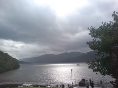
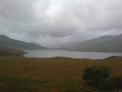
The first few miles of the road were nice enough, but unspectacular, until I drove out of the forest towards Loch Arklet:
Loch Arklet


The trees gave way to a barren beauty that I've seen so many times in Scotland, but seldom elsewhere. The wind was howling up the Loch and I could almost hear the voices of the past in a lanscape that, at first glance, had changed little in hundreds of years. Even in the car, I felt at the mercy of the elements as the sky closed in.
Driving on, I realised that this landscape was actually anything but natural; the loch is a reservoir, there by way of a huge stone dam at the distant end of the photo above. An amazing feat of human ingenuity, and in its own way, as visually arresting as the landscape around it. Here's the water that I might be drinking, miles away from the drip of my tap, harnessed by the brains of architects and engineers.
I drove on, down a steep gorge, plunging towards the shore of loch lomond, seen momentarily in a ray of sunlight, the one concession that the weather gave us:
Loch Lomond from Inversnaid
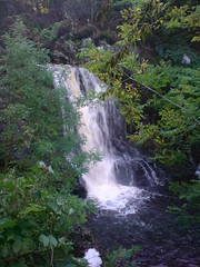
I soon realised that we were smack bang in the middle of Scotland's most travelled footpath, the West Highland Way, and recognised from an old classroom video a wooden walkway and bridge, with a perfect waterfall careering down beneath it feeding the loch:
Waterfall and plunge pool, Inversnaid
You know, the strangest thing is that I was never really a physical Geographer-for me, at Unversity, I was interested in Development and the political and social aspects of the subject. I have, however, always been the kind of person who will look out of the window of a train rather than read the paper; stop the car and get out rather than drive by; in short, enjoy and experience what's around me. For me, that's what Geography is all about- Appreciating and understanding your world, whether it's a city, a village, a mountain, a border, a people. So today, I took a little time to appreciate. I'm still in awe and wonder of the constructs, both human and physical, which make up my surroundings. And I'm still learning the Geography that links it all together.

Sunday, September 28, 2008

" The pain is distant to us, but here it is seething"

Categories: s1 and s2, Environmental Hazards, Rural Land Resources, Geography General
Sometimes when teaching earth forces, I feel as though I skim over the real human tragedy involved in these natural events. It's a topic with great opportunities for interaction and exploration, and I was hoping to do a group activity on earthquake proof buildings using coffee stirrers and marshmallows. While I'm sure students will enjoy doing this, I didn't want the idea to be lost that people are trying to design these buildings for a very real purpose. So, on Tuesday, I'm going to use this clip below from youtube, a news report on the Sichuan Earthquake


I'll then talk about the earthquake damage-the school is a good point to stop the clip and see the effect of the quake on the buildings. I don't want to give too much away about earthquake proofing, but I'll maybe then use some images as a starter-which building would be most likely to survive a quake and why? There's also the New Bay Bridge site as a whiteboard activity for individuals/ groups, and another flash animation about foundations which could be used. I'm also looking forward to hearing and seeing the results of the random individual homework tasks decided by the random name generator on classtools!
I did something similar with s1, and we'll look at some of the results before touring the continents on Google Earth and asking what links the individual places to Brazil. I've got a pretty standard period with Higher, looking at The Dales, but that's OK, as I'm still converting the various mobile files from Wednesday. Perhaps a variation on the wordmat with a wordle would work here?

Tuesday, September 23, 2008

Back to the Playroom


Categories: Rural Land Resources, Advanced Higher, s1 and s2

Been thinking about Higher tomorrow, after another missed period today (this time not work related). I have marked the Lithosphere interim tests and although the marks are good, there are some statements in papers which are, in football speak, hitting the crossbar. I've taken 12 lines from papers which represent either common errors or common 'nearly there's, and I am setting a 'How would you?' exercise at the start of the period- How would you change these lines to get extra credit out of them? This is not about highlighting your mistakes, but helping me get round everyone to improve your answers, and showing you in some instances how little that would actually take. I am still getting used to the promethean board after using an RM for nearly four years, but if I could capture the screen and stick the results up here, this will serve you well for revision.

I also might reprise another exercise from a while back. One of the questions which wasn't answered well was the one where you were asked to describe the difference between coastlines of erosion and deposition-far too much explaining going on. I remember having a similar problem two years ago with a Biosphere question, and I got students to record their answers. This could be done by mobile (perhaps then bluetoothed) or by using my laptop. The results last time were interesting as students a) suddenly realised how obvious some of their errors were just from listening back, errors that they were not seeing as they were writing, and b) when set to time, recall had to be concise. After this, it's onto the Dales, and the start of another case study...

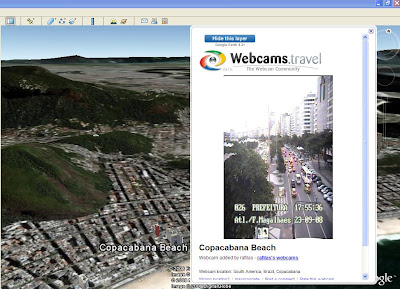
Finally back in the Geography rooms with s1. In many ways, where we were was better, being in the newer building with one class, but I was missing my toys ;-) Will finally be able to use Google Earth, great for the Brazil topic, but also for general interest. I found a great world webcams link from Wycombe High school, and this reminded me that you can now open a webcam layer in Google Earth. Might let s1 do a bit of exploring tomorrow, like I've been doing in the image above.

Last, but not least, Advanced Higher are working on Ardentinny write up, a really good opportunity for use of some of the Google Earth and Google Maps uses for Geographical Study. I think I'll rotate who has a go at this, and we'll share the results.

Sunday, September 21, 2008

Blackhole postponed- Thank you BBC!


Categories: Rural Land Resources, s1 and s2, Environmental Hazards, Urban

Apparently, we've all been granted a stay of execution on Earth, as the Hadron Collider has broken down. I wonder if Fiat built it? (long story about my first ever car, a Panda) ;-). So why am I looking at this? I had been exploring the BBC news section after reading an article by Ollie Bray, where he talked about how he used the news with all of his classes as a starter. I have used news articles and clips from the bbc before, but never with that consistency,and sometimes it's nice to get a wee reminder of some of the great resources that are out there for students and teachers.

From very little searching, I've found a video of a newsclip I had fruitlessly hunted for last week which fits in perfectly with Higher and your work on The Cairngorms and National Parks. I wondered if we could correctly identify all the groups of land users,land owners, the conflicts and how the NP has dealt or is dealing with them? This would be a really good way to show how a) there are always current examples to support case studies in the news, and b) reading a good newspaper or taking an interest in current affairs over and above newsround is vital! I'll also be giving back interim tests tomorrow.

I further found a good clip to link in with s2 mind movies, due to be sampled tomorrow. I had asked you to go and write a sensory account of what you would experience had an earthquake woke you from your sleep. We had a good discussion around some of the things that you would be very aware of- feeling your way in the dark, listening for sounds, calling out for family etc. A Chinese teacher kept a blog to record his very personal feelings when an earthquake struck his hometown and ended up losing his job as a result. I wonder how many of you would have had similar feelings had you been in his position? This might also be a good opportunity to send a story round the class, with each pupil building a piece of the story...

I know I'll get hounded for The Simpsons in Brazil tomorrow by s1, but I'd also like to use the National Geographic puzzles flagged by Tony Cassidy as a plenary to the Brazil mapping exercise. I'll shoehorn this in at some point in the week.

Finally, Advanced Higher return from Ardentinny, and I'll be giving you some pointers as to how to write up the results of your rivers fieldwork. Remember, this will be the basis of the Physical part of your GMT NAB. It's also a good taster for the kind of analysis that is required in your Geographical Study, worth 40% of your final mark...

Thursday, September 18, 2008

Trace the taste

Categories:Rural
I was sitting here tonight wondering how I could teach rural geography of LEDC's to my once-a-week s4 class. It's a topic that I have to confess I struggle to liven up. If you think we've spent the last couple of weeks looking at commercial arable farming in France, I'm sure some of you must be wondering the relevance. So I started considering whether we even eat much of what is grown in France, and then thought about what I'd had for dinner in the last two evenings. I realised that studying what goes on in LEDC's is probably much more important to you and your lifestyles. Virtually everything I've eaten in the last two days has travelled a fair distance to be on my plate, and most of it comes from places like India. I could feel guilty about the food miles travelled, but then I have to ask myself, if I buy local all the time, what happens to the people in India and other places who are relying on guys like you and me buying their rice or whatever it is to earn a living? This is something I'd like to explore with my class:-


1) Where's my Dinner?- What did you have to eat last night, and where's it from?


2) Plain food or Plane food?- A discussion of what's wrong with food miles?


3) From my hands to yours- Who is responsible for growing the food I'm eating?


4) Celebrate the differences?- Finish with a photo montage of rice farmers in India- Compare and contrast with farming in MEDC's

I'm hoping that this helps us approach the topic in a way that shows you the impact on your own lives of something that we don't give much thought to.

Tuesday, September 16, 2008

Stray maps and the migration of the British Isles


Categories: Rural Land Resources, Advanced Higher

We are looking at National Parks tomorrow in Higher, and I would like to show you why certain parks attract more visitors than others. I've spent much of today trying to work on UK overlays for Google Earth. I have one showing the location of National Parks, some with climate, topography and population data and two with transport. Haven't had the time to put these all together in a folder yet, but would like to use these in a decision making exercise, together with some selling points on the parks from their respective websites. We'll set up in groups and each group will be given a British city as starting location, but no other restraints. I want you to consider as groups which park you would visit and why, presenting back to the class. This will then lead into a homework activity and a common past paper question. It might be an idea, then, to prepare to give reasons why you have not chosen certain places too. I'll tell you in advance that my overlays do not fit exactly, hence the reason I'm not sharing them here- there seem to be some bizarre plate movements which have Ireland migrating towards Wales and Cornwall desperately trying to join with France!

Noel Jenkins gave me a bit of advice on why this was happening, but also posted a nice article which , if your studying Advanced Higher, you should really bookmark. I have spent some time tonight looking at a few of the suggestions and there are some excellent ideas for making your Study stand out from others. I was doing proportional symbols maps, migration flows and transects in Google Earth with a bit of tinkering, and it's something I'm sure that you could do a lot easier than me. I'll let you have a look at this tomorrow, along with some of the work on sampling.

Monday, September 15, 2008

Stories from the rubble?


Categories: s1 and s2

Already feeling like I've been out of school too often this year, so I'm really starting with an apology to my classes. S1 in particular have been left a few times, so tomorrow I'll be giving you some relaxing music to help you with your work- after a brief 'where in the world?' type starter. S2 did the Volcano experiment today. It actually worked, but not as well as some of the pictures and videos. We did get a really thick 'lava' flow, thicker again when I added some extra soda. Got a bit of discussion about the workings of a volcano and a little more about what volcanic regions can do to minimize their impact (diversion ditches etc). Tomorrow, we've got a little bit of work to tidy up and then it's on to earthquakes. I wonder if we could do a bit of scene setting here with a mind movie? An opportunity for a bit of story telling...

Sunday, September 14, 2008

Tired legs, body and brain


Categories: Geography General, s1 and s2

I cycled in the Pedal for Scotland event today, and my knees feel like someone has hit them with a sledgehammer. This general poor state has spread to my brain too. I was reading a blog that I subscribe to and saw reference to a google maps streetview game. Had a look at it to see if it would be a nice homework for s1. I'm afraid I got killed several times by a security guard at the warehouse, probably because I couldn't work out the coded letter. I am sending out a plea for help on this one...

Also saw one for the holidays with onion map, where you can view a city by its major attractions, including price, admission times etc. Spent some time looking at Barcelona, a place I really want to visit again in the future (image above).

Finally, I blogged about Thirst and a class homework recently, and was interested in another eco-aspect of water consumption. This is a story about a company in New York, who are selling New Yorkers bottled NYC tap water on the grounds it's more environmentally friendly as it doesn't have to travel far! Only in America :-)

Thursday, September 11, 2008

Building a Case Study


Read this document on Scribd: Cairngorms


Categories: Rural Land Resources
Tomorrow, I'm retracing my steps to two years ago for the double Higher period. I'm going to spend much of the first period introducing Rural Land Resources properly, but in a way where hopefully I can draw on peoples' own experiences. I'll be asking you to think about your parents/grandparents, the type of work they did or do, how well off you (they?) reckon they are or were, how many family holidays you take and so on. This should help us profile the changes in wealth and leisure time which shall lead us in to why some areas of Britain need protection from increased visitor numbers.
In the second period, I'm going to use an assessment wordmat for the Cairngorms (above) alongside a Google Earth tour. This should help you start to build the comprehensive case study knowledge that you need to be a success in the typical exam questions given for this part of the Higher.

Song for Soufriere?


Categories: s1 and s2

I'm really enjoying teaching s2 again this year - it's nice being able to fully explore the sidestreets of topics in a way you can't when you are teaching to strict time for exams, and I like spending time with this class a lot too. Today, we were looking back at Montserrat (nice maps), and tried to bring together everything that we had learned about Volcanoes starting with a card sort (try it again for revision) on why eruptions occur. We also looked at the potential for a singing case study (some interest stated!), and prepared for a task where we try to summarise the threats/benefits to people, the precautions that prone areas can take against Volcanoes and the ways in which people respond to them...a really full period! There was lots of purposeful noise, and although it's going backwards a bit, I'd like to maybe do a Volcano experiment with this group-I'm sure there would be lots of good questions from this, and I found a stack of clips which could perhaps help answer some of them.

Cairo Time


Call to Cairo - D200 Timelapse from Oliver Wilkins on Vimeo.

Saw this on Ogle Earth this morning. I'm a sucker for motion trails...

Tuesday, September 09, 2008

Googling for brainwaves- How not to read


Categories: Rural Land Resources, Advanced Higher

It has become quite apparent to me of late that google, while responsible for revolutionising the way that we research information, is helping some of my students become economical with the use of their intelligence! Let me explain.... I asked Higher to bring me in a newspaper article which referred to a land use, or land use conflict at the coast. I should have been explicit in saying the British coast, which would have avoided the several Australian and American examples which top the google lists. I got one article about biogeochemistry, which I have asked for a definition of from the student concerned, and several others which were, to say the least bizarre :-0 I wondered if I would have had a different response had I insisted that no internet sources were allowed? Would this have seen a better quality of response? I may try this...

Tomorrow, we'll stick with the theme of news, and start a new topic, Rural Land Resources, with a now traditional 'Have I got News for You?' Exercise. This topic really requires you to be at the top of your game in naming examples, so lots of these in the weeks to come.

I would love to say with certainty that I'll do some work on sampling etc with Advanced Higher, but Rome Trips and open days are, I would imagine, going to play havoc with my class size for the next week or so, so I'll play this by ear.

Malawi, Water and more of that

Categories: Geography General, s1 and s2
THIRST
View SlideShare presentation or Upload your own. (tags: design crisis)

This has been posted about on loads of blogs, most recently on Ollie's. It's a really thought provoking and humbling piece of work, and I decided to use it with my s1 class today. I've recently received quite a bit of correspondence from our Malawi link school and really need to get moving on our side of things. Mathandani School have sent us some very personal views on how climate change has impacted on their lives. Many of the children, who are from rural communities talk about the impact of changing crop cycles due to longer and less predictable dry seasons. I thought as well as our responses (no doubt talking about the deluge of rain we've had) it would be good if we could do a project about how we account for our uses of water. I've asked Mr Kerr if he'd let us use the ecoschools blog as a platform for this, as I don't want this to be seen as just a Geography project. In a week's time, hopefully we'll see lots of responses about how s1 have tried to think about the water they are using before they use it. I've also asked History and Modern Studies to become involved in linking projects as I think we all have a huge role in citizenship education and should really be working on the link together for the sake of pupils experiences.

Homework for Higher


Categories: Lithosphere

A small homework task, which worked well last year to reinforce lithosphere mapping. Please click here or on the photo. I'll stick up something to help you correct this at another date.

Monday, September 08, 2008

Beware the alien sheep


Categories: Geography General, s1 and s2

Been out in the half light tonight trying hard to clear my head of a day of personal disappointments, and to build my fitness for a 50 mile bike ride at the weekend. I took a couple of moving shots on my phone, just to see how they turned out (want to take some pics of my group on the move on Sunday), and noticed the strange devil eyed beast on the left when I put my photos on the laptop a few minutes ago. Spent a few moments playing with a 3D spider on a map for no good reason, and then decided that s2 are worth an active lesson tomorrow after a couple of periods of bookwork in my absence. Will need to tinker with my relief lesson for my other s1 tomorrow, as in the absence of Google Earth, I didn't feel today's worked quite so well. I'm doing coastal mapping with Higher, might do drag and drop for this on the interactive whiteboard (which at the moment isn't being interactive). Right, sleep might be a good idea, before I start talking more sheep and spiders...

Sunday, September 07, 2008

Tiny post...

Categories: Advanced Higher, s1 and s2
Well, it's been very much a working weekend, and I'm just taking a (kind of) break to listen to the flood of praise for Andy Murray, who just beat Rafa Nadal tonight. I will be out tomorrow morning, but back for Advanced Higher. We had a really good discussion about your questionnaires on Thursday, some really excellent evaluative work. We'll continue to have a look at this and some statistical testing we could use on the results. This might be useful, flagged up by Graham on the sln forum. Relief for s1 (That's about maps, not me being absent).Right, back to work...

Tuesday, September 02, 2008

Lights Out on Lithosphere

Categories: Lithosphere, Advanced Higher, s1 and s2

Click here for full screen version


I was talking to Miss Gordon today about classtools and reminded myself about how good this site can be for the whiteboard. I think I'll use a few lights out activities like the one above as a recap on today's lesson with Higher. This one shows the twelve apostles, of which there are only seven or eight left. I'm also using Chesil Beach, Hurst Spit, Bournemouth and a deserted part of Harris for others. I might also do a bit of 'quick on the draw' but through giving you photos rather than just the name of the feature. This will make sure that you are recognising landscapes and that you can explain them with annotated diagrams, particularly important for crash students. After tomorrow, we should be just about finished lithosphere.
Advanced Higher have the joy of stopping unsuspecting shoppers in the morning, but I'll have to rush back for s1, who will be learning about Grid References and playing a little game to help with this. To make sure we get on to this, I might use the countdown clock in classtools while giving you assorted tasks related to today's work as I was out.
Lastly, this is not geographical at all, but I just really like it, especially the javelin